If you have spent any time scrolling through social media, you probably know what modern travel looks like. You see the same places over and over again. The crowded cliffs of Santorini, the long lines at Banff National Park, and the traffic jams leading to the Grand Canyon. It can feel like every beautiful corner of the Earth has already been mapped, tagged, and filtered.
But the world is massive. For every famous landmark surrounded by selfie sticks, there are dozens of incredible natural wonders quietly existing completely under the radar. These are places that require a bit more effort to reach. They do not have paved parking lots, luxury gift shops, or reliable cell phone service. What they do have is raw, untouched beauty.
If you are tired of algorithm-driven travel and want to experience nature without the crowds, you are in the right place. Here is a guide to some of the world’s most incredible hidden natural wonders that have not yet been taken over by the internet.
TLDR (Too Long; Didn’t Read)
- The Problem: Social media has made popular natural spots overcrowded and stressful to visit.
- The Solution: Travel further off the beaten path to places that lack easy infrastructure.
- The Spots: This article covers seven hidden gems, including alien-like rock formations in New Mexico, an underwater forest in Kazakhstan, a massive jungle cave in Vietnam, and volcanic geysers in Russia.
- The Catch: You will need to trade convenience for adventure. Expect rough roads, long hikes, and zero cell service.
- The Takeaway: Keep these places wild by practicing leave-no-trace principles and avoiding exact GPS geotagging.
1. The Bisti/De-Na-Zin Wilderness, New Mexico, USA
When people think of the American Southwest, they usually think of Zion, Arches, or Monument Valley. But tucked away in the high desert of the San Juan Basin in New Mexico is a landscape that looks like it belongs on Mars.
The Bisti/De-Na-Zin Wilderness is a 45,000-acre badland filled with strange, gravity-defying rock formations. You will find massive stone mushrooms, colorful striped hills, and petrified wood scattered across the dirt.
Why It Remains Hidden
There are no marked trails here. There is no visitor center, no water sources, and no cell service. If you want to explore the Bisti Badlands, you have to rely on a physical map, a compass, or a downloaded GPS track. Because it requires off-trail navigation and the summer heat can be dangerous, casual tourists tend to stay away.
How to Visit
- Getting There: The wilderness area is located about three hours northwest of Albuquerque. The access roads are mostly gravel.
- Best Time to Go: Spring and Fall. Summer is dangerously hot, and winter brings freezing temperatures and impassable muddy roads.
- What to Pack: At least a gallon of water per person, a handheld GPS device, sturdy hiking boots, and sun protection.
- Pro Tip: Look for the formations known locally as the “Cracked Eggs.” They are large, egg-shaped rocks that look like they are about to hatch alien creatures.
2. Lake Kaindy, Kazakhstan
Deep in the Tian Shan Mountains of Kazakhstan sits a lake that hides a surreal secret. Above the water, it looks like a beautiful alpine lake surrounded by steep, pine-covered mountains. But sticking out of the bright blue water are the bare, silver trunks of dead spruce trees.
Lake Kaindy was created in 1911 after a massive earthquake triggered a limestone landslide. The landslide formed a natural dam, trapping a river and flooding the forest. The water is so cold that the submerged trees never decayed. If you look below the surface, the underwater branches still have their needles intact, creating a ghostly underwater forest.
Why It Remains Hidden
Kazakhstan is not on the typical international tourist circuit. Furthermore, getting to Lake Kaindy requires a long, jarring drive. The last section of the road is so rough that you have to cross a river multiple times, meaning a serious 4×4 vehicle is completely necessary.
How to Visit
- Getting There: Fly into Almaty, Kazakhstan’s largest city. From there, you need to hire a local driver with a high-clearance 4×4 or join a specialized tour. The drive takes about five hours.
- Best Time to Go: Late spring to early autumn. The roads are often completely blocked by snow in the winter.
- What to Pack: Warm layers (the weather changes rapidly in the mountains), motion sickness medication for the bumpy ride, and a polarizing filter for your camera to cut through the water’s glare.
3. Hang En Cave, Vietnam
Son Doong is famous for being the largest cave in the world, and because of this, its waitlist is years long and the tours cost thousands of dollars. But located in the exact same national park is Hang En, the third-largest cave in the world. It is just as magnificent, much more accessible, and far less crowded.
Hang En is so massive that it has its own beach, its own jungle, and its own microclimate. To reach it, you have to hike through deep jungle valleys and wade across a river more than two dozen times.
Why It Remains Hidden
It is overshadowed by its bigger brother, Son Doong. Additionally, you cannot just walk up to Hang En. The Vietnamese government strictly limits access to the Phong Nha-Ke Bang National Park to protect the delicate ecosystem. You can only enter with an officially licensed local guide company.
How to Visit
- Getting There: Travel to the town of Phong Nha in central Vietnam. From there, you will join a licensed trek.
- The Trek: The hike requires a high level of physical fitness. You will hike for hours in high humidity, camp overnight inside the cave on a sandy beach, and hike back out the next day.
- What to Pack: Quick-drying clothing, high-quality water shoes or jungle boots (your feet will be wet the entire time), strong insect repellent, and a headlamp.
4. Tsingy de Bemaraha, Madagascar
Madagascar is already a remote destination, famous for its unique wildlife like lemurs. But the western side of the island holds a geological marvel that looks incredibly hostile to human life. Tsingy de Bemaraha is a “forest” of razor-sharp limestone needles that tower hundreds of feet into the air.
The word Tsingy translates loosely from the local Malagasy language as “where one cannot walk barefoot.” The landscape was formed by millions of years of groundwater eroding a massive limestone plateau. Today, it is a labyrinth of jagged rocks, deep canyons, and rare wildlife that has adapted to live in this harsh environment.
Why It Remains Hidden
Infrastructure in Madagascar is notoriously difficult. To reach the Tsingy, you have to endure one of the worst dirt roads in the world. It is a punishing, multi-day journey in a 4×4 vehicle, and the area is completely inaccessible during the wet season.
How to Visit
- Getting There: From the capital city of Antananarivo, you must fly or drive to the coastal town of Morondava. From Morondava, it is an 8 to 10-hour drive on a deeply rutted dirt track, including two river crossings on basic wooden ferries.
- The Experience: You navigate the rocks via a via ferrata system—a series of iron ladders, cables, and suspension bridges bolted into the sharp rocks. You must wear a climbing harness and clip in at all times.
- Best Time to Go: The park is only open during the dry season, from May to November.
5. Salar de Tara, Chile
Everyone goes to the Atacama Desert to see the Valle de la Luna (Moon Valley) and the El Tatio Geysers. They are beautiful, but they are packed with tour buses. If you want true isolation in the driest desert on Earth, you need to head toward the borders of Argentina and Bolivia to find Salar de Tara.
Located at an extreme altitude of over 14,000 feet (4,300 meters), Salar de Tara is a high-altitude salt flat surrounded by massive volcanic rock pillars known as the “Monks of the Pacana.” The contrast between the stark white salt, the bright blue high-altitude lagoons, the pink flamingos, and the yellow desert grass is breathtaking.
Why It Remains Hidden
The altitude is punishing. You can easily get altitude sickness if you do not acclimatize first in the town of San Pedro de Atacama. Furthermore, there are no roads. You drive off-road through deep sand and rocky terrain. If you do not know the exact route, it is very easy to get hopelessly lost in a deadly environment.
How to Visit
- Getting There: Start in San Pedro de Atacama. Because there is no cell service and no marked tracks, you must hire a local guide with a very capable 4×4 vehicle. Do not attempt to drive this yourself in a rental car.
- Best Time to Go: September to December, or March to May.
- What to Pack: Tons of drinking water, altitude sickness medication, extremely warm clothing (the wind at this altitude is freezing), and heavy-duty sunglasses.
6. The Danakil Depression, Ethiopia
If you want to feel like you have left Earth completely, the Danakil Depression in northern Ethiopia is the place to go. It is one of the lowest, hottest, and most geologically active places on the planet.
Here, three tectonic plates are slowly pulling apart. The result is a landscape of boiling sulfur springs, neon green and yellow acid pools, active volcanoes, and vast plains of cracked salt. It is beautiful, but it is also a harsh, toxic environment.
Why It Remains Hidden
It is extremely remote and physically demanding. Average daytime temperatures frequently exceed 120°F (50°C). Historically, the region has also seen political instability, meaning travelers must be escorted by armed guards. It is the definition of extreme travel.
How to Visit
- Getting There: You must join a specialized, organized expedition starting from the city of Mekele. The convoy usually includes several 4×4 vehicles, guides, cooks, and military escorts.
- What You Will Do: You will sleep on basic wooden cots under the stars, hike up the active Erta Ale volcano in the middle of the night to see the lava lake, and walk among the acid pools of Dallol.
- What to Pack: Rehydration salts, wet wipes (there are no showers), lightweight long-sleeved shirts to protect from the brutal sun, and a gas mask or thick scarf for the toxic sulfur fumes.
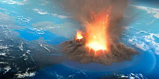
7. The Valley of Geysers, Kamchatka, Russia
Yellowstone National Park is famous for its geysers, but it is not the only place with massive geothermal activity. The Kamchatka Peninsula in far eastern Russia is home to the Valley of Geysers, which contains the second-largest concentration of geysers in the world.
The valley sits inside a deep canyon of the Geysernaya River and is packed with boiling springs, mud pots, and geysers that shoot steam and water high into the air. It is a pristine, untouched wilderness teeming with brown bears.
Why It Remains Hidden
Kamchatka is on the edge of the world. It is closer to Alaska than to Moscow. On top of that, there are literally no roads leading to the Valley of Geysers. The only way to get there is by flying in a helicopter. To protect the fragile ecosystem, the government heavily restricts the number of tourists allowed to land there each year.
How to Visit
- Getting There: Fly into Petropavlovsk-Kamchatsky. From there, you must book a spot on a scheduled helicopter tour. Weather conditions frequently cancel these flights, so you need a flexible schedule.
- Best Time to Go: July and August.
- The Experience: You will land in the valley and walk along elevated wooden boardwalks with an armed ranger (for protection against bears). You are not allowed to step off the path.
How to Find Your Own Hidden Gems
You do not need to fly to Madagascar or Kamchatka to find places without crowds. You can find hidden natural wonders in your own state or country. Here is how to stop following the algorithm and start finding real adventure:
1. Stop Using Social Media for Research
If a place has a million views on a short video, you are already too late. Instead of using social media apps to plan your trips, go back to old-school methods. Read physical guidebooks, look at topographical maps, and read regional hiking blogs written by locals.
2. Follow the “Two-Mile Rule”
Most tourists will not walk more than two miles from their car. If you go to a popular state or national park, look at the trail map. Find the trails that are longer than three miles and have a decent amount of elevation gain. The moment you hike past that two-mile mark, the crowds will vanish, and you will have the nature entirely to yourself.
3. Talk to Park Rangers
When you arrive at a natural area, do not ask the rangers, “What are the best things to see?” That will get you a list of the most popular, crowded spots. Instead, ask them, “Where do you go on your days off?” or “What trail is the quietest on a Tuesday morning?” Park rangers love nature and usually know the quiet, beautiful corners of their parks.
4. Keep It Hidden
If you do find an amazing, untouched spot, think twice before posting it online with the exact GPS coordinates. Geotagging has ruined many fragile ecosystems because sudden bursts of internet fame bring thousands of people to places that do not have the infrastructure (like trash cans and bathrooms) to handle them. Share your photos, but keep the exact locations vague.
FAQs
1. Is it safe to visit these hidden natural wonders?
Safety is relative. These places lack modern infrastructure, which means emergency medical help is usually far away. You are trading the safety of paved roads and visitor centers for raw adventure. If you visit these locations, you must mitigate risks by hiring licensed local guides, bringing proper gear, understanding the local weather, and knowing your own physical limits.
2. Why shouldn’t I geotag these locations if I visit them?
Geotagging provides the exact GPS coordinates of a location to the public. When an obscure, fragile natural area goes viral, it often experiences a massive influx of visitors. Without paved trails, parking lots, or waste management, the local environment gets destroyed quickly. Wildlife is disrupted, vegetation is trampled, and trash accumulates. It is better to name the general region rather than the specific spot.
3. Do I need specialized gear for off-the-beaten-path travel?
Yes, usually. Unlike popular tourist spots, hidden gems require you to be self-sufficient. Depending on the location, you may need a satellite communicator (like a Garmin inReach), a high-clearance 4×4 vehicle, water purification systems, advanced first aid kits, and proper layering for extreme weather. Always research the specific demands of the environment before going.
4. Are these remote trips more expensive than normal vacations?
They can be. While you aren’t paying for luxury hotels or expensive museum tickets, you are often paying for specialized logistics. Hiring a private 4×4 driver in Kazakhstan, booking a multi-day caving expedition in Vietnam, or chartering a helicopter in Russia costs significantly more than a standard bus tour. However, your money usually goes directly to local guides and communities rather than large corporate hotel chains.
5. How can I prepare physically for trips like this?
Hidden wonders almost always require physical effort to reach. Start by building your cardiovascular endurance through hiking, running, or cycling. Practice hiking with a loaded backpack, as you will often need to carry your own water and gear. Most importantly, break in your hiking boots well before your trip to avoid trip-ruining blisters.


Leave a Reply